Itinerary 2017 ed.
Tracks 6000 was born from our passion for mountaineering and mountain bike, our constant search for new places and itineraries, and the idea of presenting our territory under an unusual and original point of view. The circular track starts and finishes in Val di Sella, close to Borgo Valsugana, in the east part of Trentino region. This is not a random choice: this location, in fact, gives an added value to the circuit and will allow those participants not willing to sleep in the open air to find accommodation facilities halfway (shelters and mountain camping). We will have to do without some “amenity” at the start and finish points: no hot shower nor accommodation will be available.
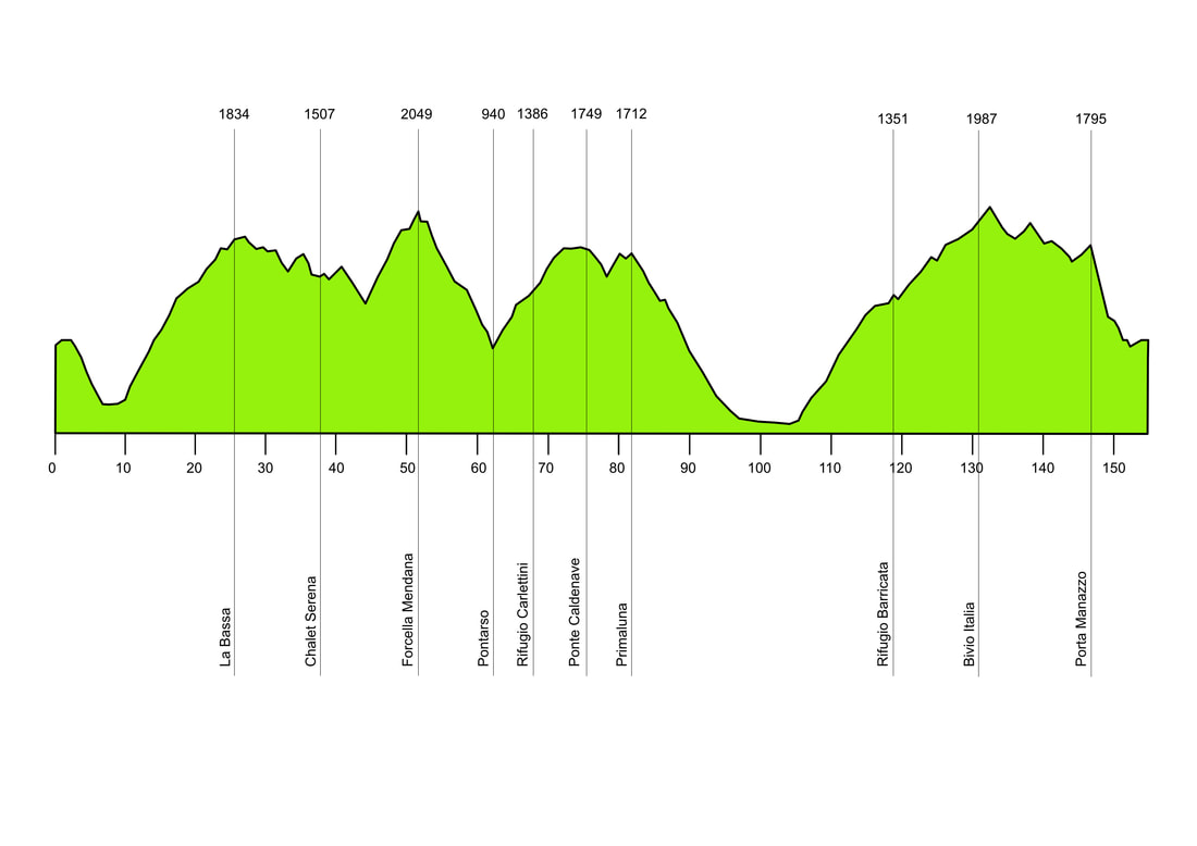
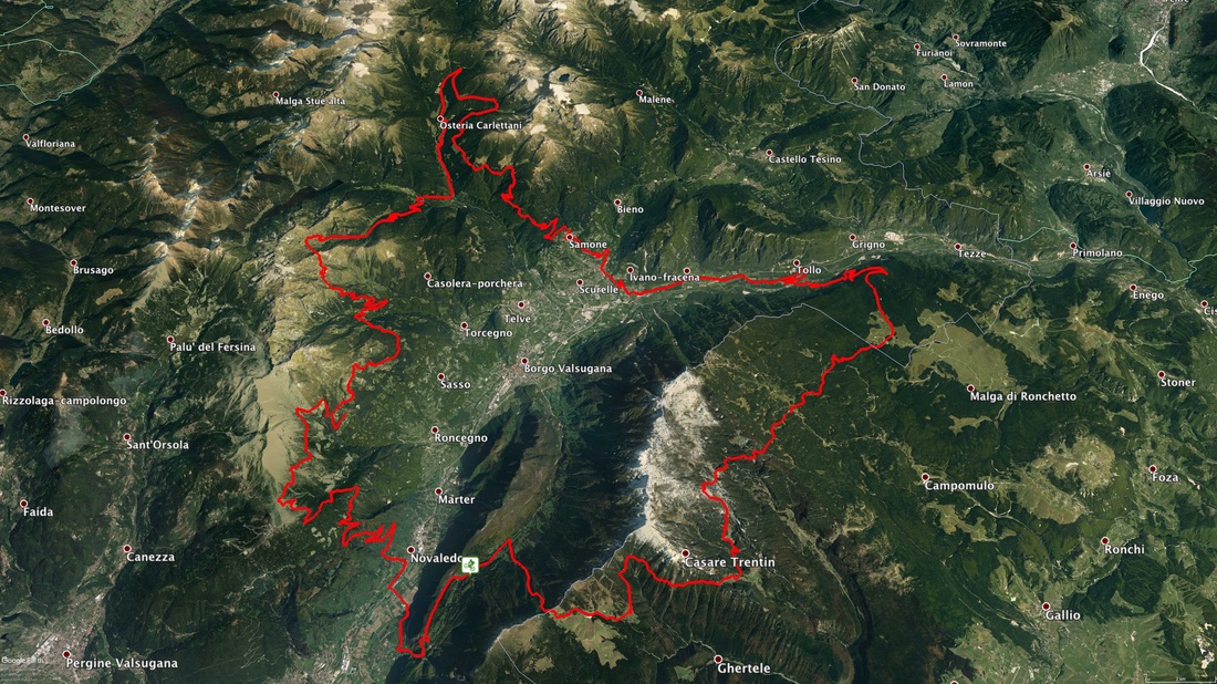
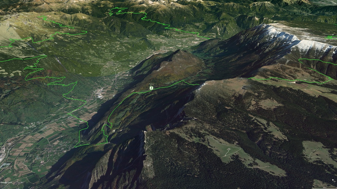
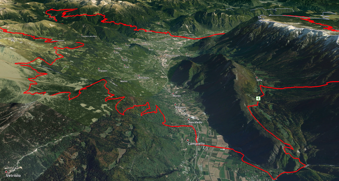
However, we will wait for you at the finish line with hot tea or, even better, with a tasty glass of red wine. Our attempt was to invite as many participants willing to join, in order to reduce at minimum the registration fee. This made us give up all the unnecessary: no “welcome packs”, no gadgets, but we will offer a roadbook, a GPS trail and a warm welcome! About 140 km and 6000 metres of positive elevation gain. The details of the track will be published by 10/7/2017 on this webpage, where we will show the trail and the roadbook. All participants will also receive the information by email. The track will partly go through the Lagorai, mountain chain located in the eastern part of Trentino region, and long the Cima Dodici chain. Valsugana, the valley of our meeting point, is between the two mountains. Here are shown 2D and 3D views of the track, still to be defined. The elevation profile is just an indication even though not very different from the definitive elevation gains. The track will be mainly (about 70%) on gravel roads, forest routes and fantastic single tracks. The parts on paved routes, although necessarily included, are reduced to minimal parts and mostly used for the transfers from one mountain chain to the other. You will mostly travel over 1000 metres altitude; therefore, you won’t have to face those problems usually due to the summer. The route has not been organized to collect metres in elevation or distance, but to allow participants to see and visit among the most fascinating places of the two mountain chains. You will cross wonderful forests and meadows, reaching 2000 metres of elevation and wild places of unique beauty. You will start from Val di Sella and then immediately nosedive towards the town of Barco. From there you will reach Novaledo, where one of the hardest rises of the day is waiting for you. This will lead you to La Bassa, at about 1800 metres altitude. Going long the slope of Mount Fravort you will arrive in Località Desene, to rise again up to Forcella Mendana (2049 mt). Then down towards Pontarso and back up to Rifugio Carlettini, cycling through Val Campelle. At this point, half track will have been run. From Rifugio Carlettini you will continue to Malga Nassere, Rifugio Malga Caldenave, Località Cenone and finally to Primaluna. After this you will descend to the town of Samone and then reach Grigno: here the dreaded rise of Barricata will lead you to Rifugio Barricata. From here, towards Mount Ortigara to reach the amazing plateau (here we are in Veneto Region), to Porta Manazzo where a high-energy exciting slope in single track will lead you back to the starting point. Elevation gain of the 2017 edition
Let’s have a look at the track
(the provisional map, with more details, can be viewed / downloaded here) |


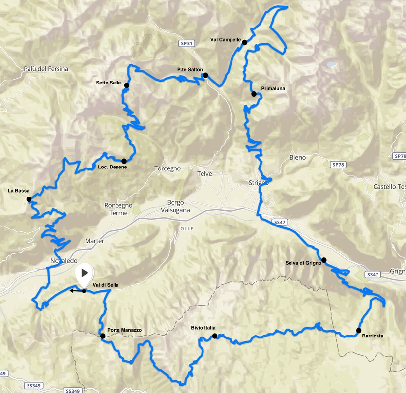
3D overview
Start at 8.00am on 29th July 2017 from Val di Sella (Trento – Italy)
