Itinerary ed. 2018The path is almost completely renewed for the second edition of Tracks6000, Unsupported Bicycle Adventure.
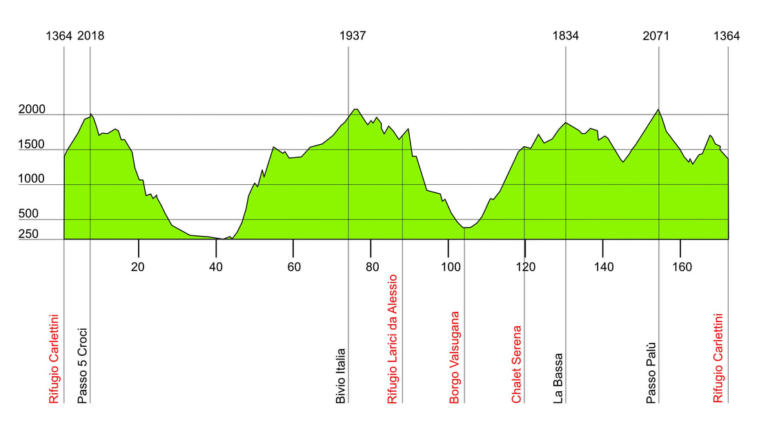
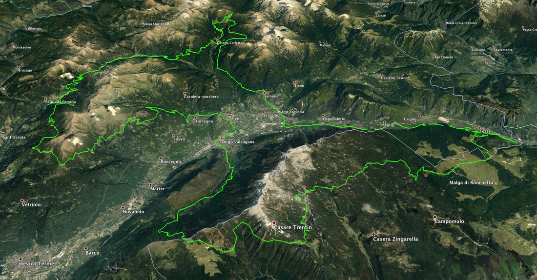
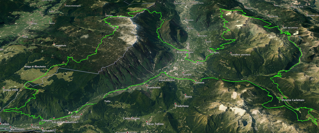
This year we will start from Val Campelle, Scurelle (TN). Our base of operations will be the Rifugio Carlettini, proven support location from the past edition. From here, at an altitude of 1364 m, you will start immediately uphill towards the Passo Cinque Croci. The view towards Cima d'Asta, the Queen of the Lagorai with its 2847 m, will leave you speechless. We will then descend to Malga Nassere, Rifugio Caldenave and, through a completely renewed and entirely cyclable path, towards Località Cenone. Still down towards the village of Samone, with destination Masi Ornè, where the hard climb will be waiting: a dirt road, which will lead you on the plateau. Get extra water, because these places are not very hospitable! After a few hours of wild mule tracks, you will return to the valley. This year Porta Manazzo (which will be travelled on foot for a maximum of 10 minutes) will give way to a certainly easier downhill itinerary. You will then cross the village of Borgo Valsugana (roughly half way of the full track) and then go up towards Desene and then arrive in La Bassa. This will be our gateway to Val dei Mocheni, the great new addition to this second edition. Traveling on adrenaline-filled single tracks and "climbing" on slopes that are not always easy, on our saddles we will reach Passo Palù, at an altitude of 2071 m, the highest point of the trail. Here, at first, an exciting descent awaits you, followed by one of the last climbs of the day which, with a still secret itinerary, will bring you back to the starting point. The overall route is about 170 km for 6800 m of positive elevation gain. As for the last edition, this year's track will be mainly on dirt roads, forest roads and single tracks (about 70%). There will be clearly some parts on paved road, but we are sure, you will bless those. The average trail height is over 1000 m. You will not have to worry about any problem related to the summer season. The track can be totally pedalled, exception made for a very short section to be necessarily walked (10 minutes) and, perhaps, a few dozen meters scattered here and there. Here are the 3D views of the route, as well as the temporary heights. We remind you that the track is still in progress. The final version will be sent to you only a few days before departure. The technical data described here, however, will not be very dissimilar to the final data.
Temporary altimetry of the 2018 edition
|
3D view
It will start on July 21st 2018, from Val Campelle


